
Heimsóknir
Flettingar
- Í dag (18.7.): 1
- Sl. sólarhring: 1
- Sl. viku: 2
- Frá upphafi: 999
Annað
- Innlit í dag: 1
- Innlit sl. viku: 2
- Gestir í dag: 1
- IP-tölur í dag: 1
Uppfært á 3 mín. fresti.
Skýringar
Færsluflokkar
Eldri færslur
The Volcanic Photo of the Year 2009
17.2.2010 | 01:55
 The greatest volcanic photograph of the year 2009 was taken of the eruption of Sarychev volcano in the Kuril Islands on the 12. June from a space craft. The Kuril Islands are one of the most remote parts of Russia. They are 56 islands which form a 1300 km long chain that stretches south from the Kamchatka peninsula, in easternmost Russia, all the way south to Japan. Russia occupied the islands in World War II and refused to give them up, but the native inhabitants were Japanese.
  The islands have formed above a great subduction zone, where the Pacific plate subducts to the northwest below the Eurasian plate, at a rate of about 9 cm per year. The international space station was at an altitude of 354 km over the Pacific on the 12. June when the astornauts witnessed the enormous volcanic plume shooting up into the atmosphere, and punching a hole up through the cloud cover. The hole was probably formed by the pressure wave of the volcanic explosion. In the center there is a high and brown colored plume of ash from the crater below. Note the snow-white cloud which forms a cap on top of the eruption plume. This is probably a part of the water-rich cloud layer which the eruption plume lifted high up into the cooler atmosphere, where the cloud condensed. A lot of things were also taking place down on Earth at the same time as the photo shows. Grey and brown pyroclastic flows are streaming along the ground from the volcano, but they can be up to 500 degrees Centigrade in temperature and move at speeds of up to 200 km per hour.
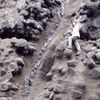
  The island of Matua is not inhabited but a few days later the Russian volcanologists paid a visit and studied the pyroclastic flows, which had entered the sea. The Sarychev eruption in 2009 transformed the island of Matua, as is shown on the photos from a NASA satellite and thermal scanner. The first photo is of Matua from 26. May 2007, and the lower photo is of the island after the eruption, from 30. June 2009. The vegetation is shown in a red color, water is darkblue and clouds, steam and ice are whie in the photo. Volcanic ash and lavas are grey and darkbrown in the photos. It is clear from the lower photo that pyroclastic flows have covered all of the north part of the island and destroyed all vegetation, but some vegetation sirvives in the southern part.
 Flokkur: Vísindi og fræði | Facebook
Bæta við athugasemd [Innskráning]
Ekki er lengur hægt að skrifa athugasemdir við færsluna, þar sem tímamörk á athugasemdir eru liðin.